
1956 Map of Tyler
USGS Topo · Published 1956About this map
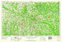
East Texas Oil Field operations dominate the landscape of the mid-1950s, stretching across the center of this survey between Longview and Henderson. The region is defined by a dense network of petrochemical development and rail infrastructure, including the Texas & Pacific RR and Southern Pacific RR lines that connect established timber and cotton centers. Significant water management projects are visible at Lake O' the Pines and Lake Cherokee, while the Sabine River snakes through the heart of the Piney Woods. To the east near the Louisiana border, the Longhorn Ordnance Works and the Rodessa Oil Field highlight the era's heavy industrial and military footprint. Cultural landmarks such as Tyler State Park and Caddo Lake State Park provide a counterpoint to the surrounding industrial sprawl, preserving sections of the natural wetlands and forest.
Find a feature on this map
323 named features on this map. Tap any name to fly to it.
Don’t see what you’re looking for? This feature index may not catch every label — zoom into the map to look around manually.
Map Details
Editions of this 1956 Tyler Map
5 editions found
Other maps of this area

1907 · Atlanta
USGS Topo · 1:62,500

1910 · Linden
USGS Topo · 1:62,500

1910 · Atlanta
USGS Topo · 1:62,500

1914 · Daingerfield
USGS Topo · 1:62,500

1920 · Kemp
USGS Topo · 1:62,500

1932 · Hosston NW
USGS Topo · 1:31,680

1932 · Hosston SW
USGS Topo · 1:31,680

1935 · Henderson
USGS Topo · 1:48,000

1936 · Kilgore
USGS Topo · 1:48,000

1937 · Troupe
USGS Topo · 1:48,000