
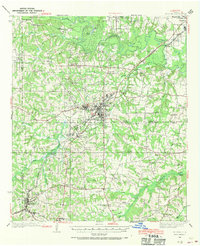
1936 Map of Kilgore
USGS Topo · Published 1936About this map
Kilgore serves as the industrious hub of this East Texas survey, revealing a landscape defined by the expansion of the East Texas Oil Field during the mid-1930s. The concentration of settlements like Oil City, Shell Camp, and Swamp City illustrates the rapid transition of rural Gregg and Rusk counties into an energy-producing powerhouse. Movement through the area is dictated by the Texas and Pacific and Missouri Pacific railroads, with rail-side stops such as Kinsloe Switch and Reeds Switch facilitating the transport of local goods and resources.
Find a feature on this map
89 named features on this map. Tap any name to fly to it.
Don’t see what you’re looking for? This feature index may not catch every label — zoom into the map to look around manually.
Map Details
Editions of this 1936 Kilgore Map
2 editions found
Other maps of this area

1935 · Henderson
USGS Topo · 1:48,000

1937 · Troupe
USGS Topo · 1:48,000

1938 · Winona
USGS Topo · 1:48,000

1939 · Henderson
USGS Topo · 1:62,500

1940 · Kilgore
USGS Topo · 1:62,500

1943 · Troup
USGS Topo · 1:62,500

1943 · Winona
USGS Topo · 1:62,500

1956 · Tyler
USGS Topo · 1:250,000

1958 · Tatum
USGS Topo · 1:62,500

1960 · Big Sandy
USGS Topo · 1:24,000