1935 Map of Henderson
USGS Topo · Published 1935About this map
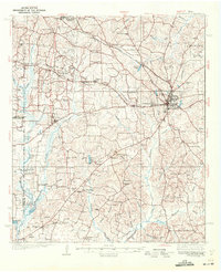
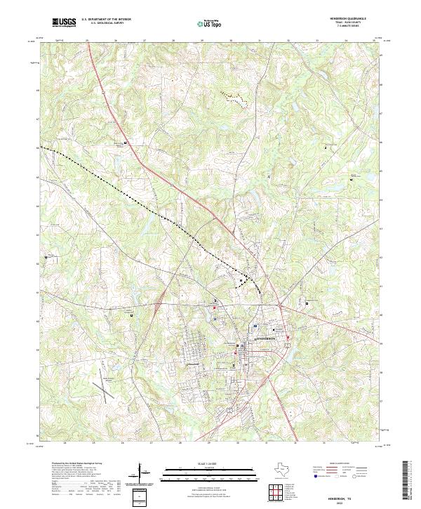
Industrial infrastructure and rural community life intersect in this 1930s survey of Rusk County, dominated by the sprawling Oil Field and its complex network of energy assets. The landscape is marked by the Beacon Pipe Line, Magnolia Pipe Line, and heavy industrial sites like the Lisbon Gasoline Company Plant and Gulf Pump Station. These modern developments sit alongside long-established settlements such as New London and Minden, as well as numerous rural schools including the Farmers Institute School and Greenville Sch.
Find a feature on this map
60 named features on this map. Tap any name to fly to it.
Don’t see what you’re looking for? This feature index may not catch every label — zoom into the map to look around manually.
Map Details
Editions of this 1935 Henderson Map
This is the sole edition of this map. No revisions or reprints were ever made.
Historical Maps of Henderson Through Time
9 maps found