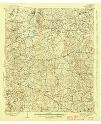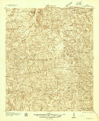
1938 Map of Winona
USGS Topo · Published 1938About this map
The St Louis Southwestern Line cuts through the northeast corner of this Smith County landscape, anchoring the settlement of Winona within a network of early Texas highways and creek valleys. This 1930s survey reveals a high density of rural social infrastructure, with dozens of family-named landmarks and community centers such as Starrville, Bascom, and Amigo. The map is particularly notable for its record of early 20th-century education, documenting numerous schools including the Maggie Murphy Sch, Dunbar Sch, and Lane Chapel Sch.
Find a feature on this map
75 named features on this map. Tap any name to fly to it.
Don’t see what you’re looking for? This feature index may not catch every label — zoom into the map to look around manually.
Map Details
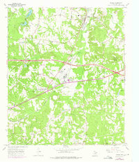
Editions of this 1938 Winona Map
This is the sole edition of this map. No revisions or reprints were ever made.
Historical Maps of Tyler Through Time
8 maps found