Loading...
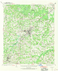
Loading map...1936 Map of Kilgore
USGS Topo · Published 1970About this map
Kilgore sits at the heart of this East Texas survey, surrounded by the dense development of the regional oil boom era. The landscape is characterized by a high concentration of schools and churches, such as Laird Hill Sch and Mt Pleasant Ch, serving rural communities that grew rapidly alongside the petroleum industry. Settlements like Swamp City and Oil City speak directly to the extractive economy that reshaped the terrain between the Sabine River and the numerous tributaries like Rabbit Creek.
Find a feature on this map
93 named features on this map. Tap any name to fly to it.
Don’t see what you’re looking for? This feature index may not catch every label — zoom into the map to look around manually.
Map Details
Date Portrayed1936
Date Published1970
PublisherU.S. Geological Survey
Map TypeTopographic
Scale1:62,500
Physical Dimensions17 x 21 inches
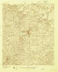
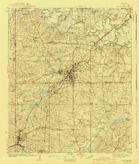
Editions of this 1936 Kilgore Map
2 editions found
Historical Maps of Longview Through Time
Featured Locations
Source Details
SourceU.S. Geological Survey
CopyrightPublic Domain