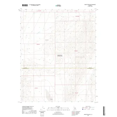
2018 Map of Wingate Wash East
USGS Topo · Published 2018About this map
The Owlshead Mountains dominate this high-desert landscape, where the jagged topography of the northern Mojave Desert meets the expansive southern reaches of Death Valley National Park. This 2018 survey reveals a terrain defined by complex drainage systems, most notably the wide corridor of Wingate Wash as it trends toward the northwest corner of the map. In the south, the dry basin of Lost Lake sits near the border between Inyo and San Bernardino Counties, illustrating the terminal drainage patterns characteristic of this arid region. The map provides an intricate look at the township and range survey lines that overlay this protected wilderness, documenting a corner of the California desert where geological features and political boundaries are the primary landmarks in an area largely devoid of modern development.
Find a feature on this map
13 named features on this map. Tap any name to fly to it.
Don’t see what you’re looking for? This feature index may not catch every label — zoom into the map to look around manually.
Map Details
Editions of this 2018 Wingate Wash East Map
This is the sole edition of this map. No revisions or reprints were ever made.
Other maps of this area

1933 · Avawatz Mountains
USGS Topo · 1:250,000

1947 · Trona
USGS Topo · 1:250,000

1948 · Trona
USGS Topo · 1:250,000

1948 · Quail Mountains
USGS Topo · 1:62,500

1948 · Leach Lake
USGS Topo · 1:62,500

1950 · Wingate Wash
USGS Topo · 1:62,500

1950 · Confidence Hills
USGS Topo · 1:62,500

1951 · Quail Mountains
USGS Topo · 1:62,500
1951 · Leach Lake
USGS Topo · 1:62,500

1953 · Trona
USGS Topo · 1:250,000