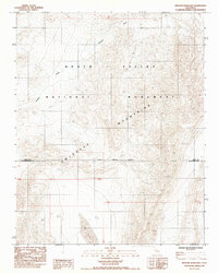
1985 Map of Wingate Wash East
USGS Topo · Published 1985About this map
Owlshead Mountains dominate the southern landscape of this mid-1980s topographic survey, where the high desert terrain meets the complex geology of the Death Valley National Monument. The map documents a sparsely populated but geographically significant area defined by dramatic elevation changes and dry drainage systems. One of the most prominent hydrologic features is the Wingate Wash, which cuts across the northern section of the sheet. To the south, the ephemeral Lost Lake sits as a distinct basin within the arid environment. This provisional map also clearly delineates the administrative and political geography of the region, specifically the National Monument Boundary and the dividing line between Inyo Co and San Bernardino Co, providing essential context for land management and historical research in this corner of the California desert.
Find a feature on this map
7 named features on this map. Tap any name to fly to it.
Don’t see what you’re looking for? This feature index may not catch every label — zoom into the map to look around manually.
Map Details
Editions of this 1985 Wingate Wash East Map
This is the sole edition of this map. No revisions or reprints were ever made.
Other maps of this area

1933 · Avawatz Mountains
USGS Topo · 1:250,000

1947 · Trona
USGS Topo · 1:250,000

1948 · Trona
USGS Topo · 1:250,000

1948 · Quail Mountains
USGS Topo · 1:62,500

1948 · Leach Lake
USGS Topo · 1:62,500

1950 · Wingate Wash
USGS Topo · 1:62,500

1950 · Confidence Hills
USGS Topo · 1:62,500

1951 · Quail Mountains
USGS Topo · 1:62,500
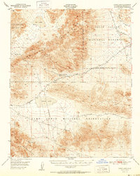
1951 · Leach Lake
USGS Topo · 1:62,500

1953 · Trona
USGS Topo · 1:250,000