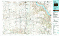
1986 Map of Winner
USGS Topo · Published 1986About this map
The Missouri River and the massive reservoir of Lake Francis Case dominate the northeastern landscape of this mid-1980s South Dakota survey, marking the transition from the rolling plains of Tripp and Gregory Counties to the river's edge. The Chicago and North Western railroad corridor serves as the primary axis for development, connecting the regional hub of Winner with towns like Colome, Gregory, and Burke. This infrastructure highlights the agricultural dependency of the era, where rail access remained vital for grain and livestock transport. South of the tracks, the terrain is defined by the Keya Paha River and Ponca Creek drainages. Numerous State Game Production Areas, such as Mc Laughlin Dam and Dog Ear Lake, indicate a landscape managed for conservation and recreation alongside traditional ranching and farming operations.
Find a feature on this map
92 named features on this map. Tap any name to fly to it.
Don’t see what you’re looking for? This feature index may not catch every label — zoom into the map to look around manually.
Map Details
Editions of this 1986 Winner Map
2 editions found
Other maps of this area

1940 · Iona
USGS Topo · 1:62,500

1944 · Iona
USGS Topo · 1:62,500

1950 · Norden
USGS Topo · 1:62,500

1951 · Butte NW
USGS Topo · 1:24,000

1951 · Naper
USGS Topo · 1:24,000

1952 · Norden
USGS Topo · 1:62,500

1955 · Martin
USGS Topo · 1:250,000

1955 · Mitchell
USGS Topo · 1:250,000

1955 · O'Neill
USGS Topo · 1:250,000

1957 · Valentine
USGS Topo · 1:250,000