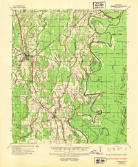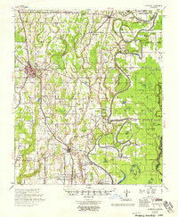
1958 Map of Winnsboro
USGS Topo · Published 1958About this map
Macon Bayou and the Missouri Pacific Railroad define the developmental landscape of central Louisiana in this late 1950s survey. The town of Winnsboro serves as a regional hub, featuring the Winnsboro Airport and the Franklin Parish Training Sch, while smaller settlements like Gilbert, Chase, and Crowville dot the railway and road corridors. The map provides a detailed view of the rural social fabric through its numerous country churches and schools, such as Boles Chapel, Old Macedonia Ch, and the combined Cuba Sch & Ch. Along the meandering riverbanks, several historical landings including Oakwood Ldg and Eureka Ldg signify the area's long-standing connection to water-based transit and commerce. The eastern boundary is marked by a complex network of oxbow lakes, including Moon Lake and Hollywood Lake, illustrating the shifting path of the river systems.
Find a feature on this map
84 named features on this map. Tap any name to fly to it.
Don’t see what you’re looking for? This feature index may not catch every label — zoom into the map to look around manually.
Map Details
Editions of this 1958 Winnsboro Map
This is the sole edition of this map. No revisions or reprints were ever made.
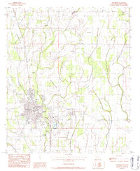
Historical Maps of Winnsboro Through Time
8 maps found