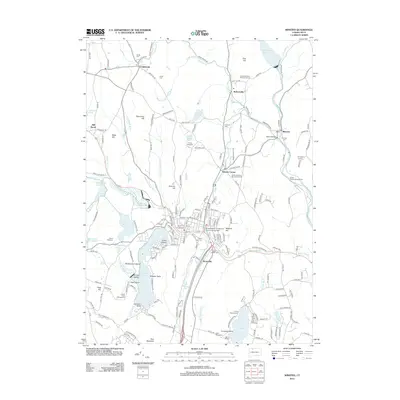
2012 Map of Winsted
USGS Topo · Published 2012About this map
Highland Lake serves as a central landmark for the Winsted area, featuring residential development around Indian Point and several named islands like Wintergreen Island and Strong Island. The landscape is defined by the significant hydraulic infrastructure of the early 21st century, including the Mad River Reservoir and Sucker Brook Reservoir, which manage the flow of the Still River and Mad River through the heart of the community. In Winsted itself, Northwestern Connecticut Community College anchors the town center near several historical burial sites such as Forest View Cem and Saint Joseph Cem. To the north and east, the map reveals a transition into more forested terrain toward Riverton and Robertsville. Notable recreational sites and historic points like Moore Bridge and the Old North Road Burying Ground are preserved alongside modern campgrounds like Camp Workcoeman and Camp Sequassen.
Find a feature on this map
197 named features on this map. Tap any name to fly to it.
Don’t see what you’re looking for? This feature index may not catch every label — zoom into the map to look around manually.
Map Details
Editions of this 2012 Winsted Map
This is the sole edition of this map. No revisions or reprints were ever made.
Other maps of this area

1887 · Granville
USGS Topo · 1:62,500

1888 · Sandisfield
USGS Topo · 1:62,500

1889 · Granville
USGS Topo · 1:62,500

1892 · Winsted
USGS Topo · 1:62,500

1892 · Granby
USGS Topo · 1:62,500

1893 · Granville
USGS Topo · 1:62,500

1893 · Sandisfield
USGS Topo · 1:62,500

1895 · Granville
USGS Topo · 1:62,500

1896 · Holyoke
USGS Topo · 1:125,000

1897 · Sandisfield
USGS Topo · 1:62,500