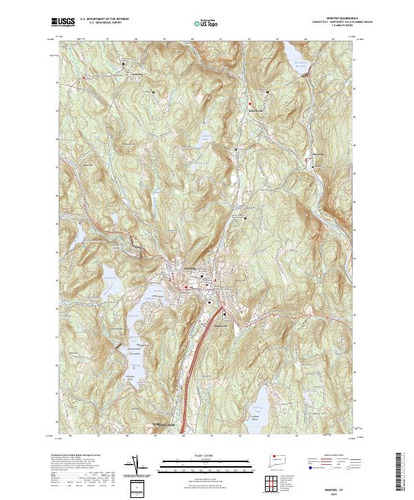
2024 Map of Winsted
USGS Topo · Published 2024About this map
Winsted serves as the primary urban hub of this Litchfield County landscape, situated at the confluence of the Still River and the Mad River. The town's historical development is evident in its concentration of civic and spiritual landmarks, including Northwestern Connecticut Community College and several burial grounds such as the Winsted Old Burying Ground. To the south, Highland Lake is a prominent geographical feature, characterized by numerous named points and islands like Indian Point and Strong Island, suggesting its longstanding role as a center for local recreation and lakeside settlement.
Find a feature on this map
174 named features on this map. Tap any name to fly to it.
Don’t see what you’re looking for? This feature index may not catch every label — zoom into the map to look around manually.
Map Details
Editions of this 2024 Winsted Map
This is the sole edition of this map. No revisions or reprints were ever made.
Other maps of this area

1887 · Granville
USGS Topo · 1:62,500

1888 · Sandisfield
USGS Topo · 1:62,500

1889 · Granville
USGS Topo · 1:62,500

1892 · Winsted
USGS Topo · 1:62,500

1892 · Granby
USGS Topo · 1:62,500

1893 · Granville
USGS Topo · 1:62,500

1893 · Sandisfield
USGS Topo · 1:62,500

1895 · Granville
USGS Topo · 1:62,500

1896 · Holyoke
USGS Topo · 1:125,000

1897 · Sandisfield
USGS Topo · 1:62,500