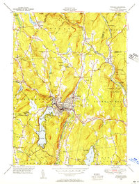
1948 Map of Winsted
USGS Topo · Published 1956About this map
The Winsted industrial center serves as the focal point of this Litchfield County survey, situated at the confluence of the Mad River and the Still River. In the mid-century era, the town's density is mapped in detail, showing its connection to the New York New Haven and Hartford railroad line. Beyond the urban core, the landscape is defined by its recreation and conservation history, featuring numerous summer retreats such as Camp Delaware, Camp Berkshire, and Camp Workcoeman nestled near West Hill Pond.
Find a feature on this map
74 named features on this map. Tap any name to fly to it.
Don’t see what you’re looking for? This feature index may not catch every label — zoom into the map to look around manually.
Map Details
Editions of this 1948 Winsted Map
This is the sole edition of this map. No revisions or reprints were ever made.
Other maps of this area

1887 · Granville
USGS Topo · 1:62,500

1888 · Sandisfield
USGS Topo · 1:62,500

1889 · Granville
USGS Topo · 1:62,500

1892 · Winsted
USGS Topo · 1:62,500

1892 · Granby
USGS Topo · 1:62,500

1893 · Granville
USGS Topo · 1:62,500

1893 · Sandisfield
USGS Topo · 1:62,500

1895 · Granville
USGS Topo · 1:62,500

1896 · Holyoke
USGS Topo · 1:125,000

1897 · Sandisfield
USGS Topo · 1:62,500