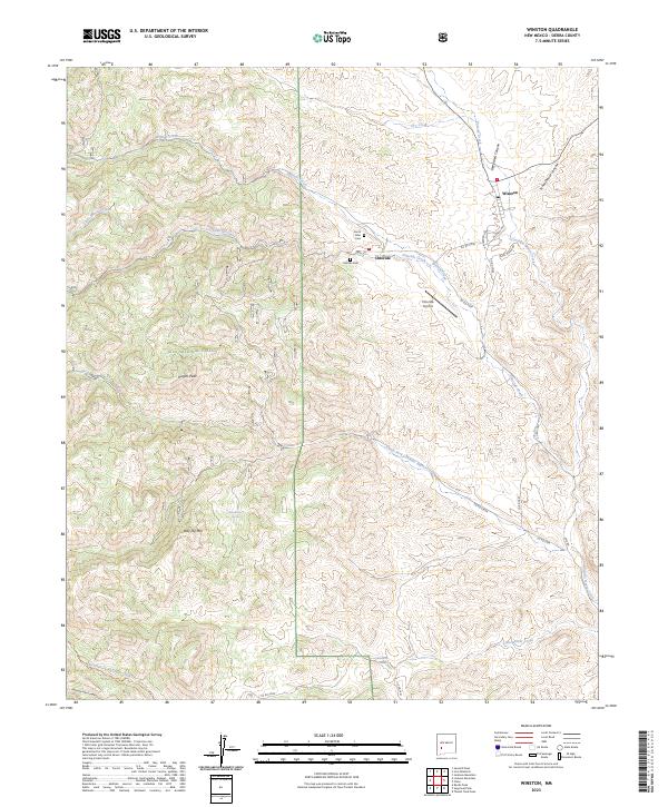
2023 Map of Winston
USGS Topo · Published 2023About this map
Chloride and Winston serve as the primary hubs of human activity in this corner of Sierra County, positioned where the high desert meets the eastern edge of the Gila National Forest. The landscape is defined by a series of deep drainage systems, most notably Cuchillo Negro Creek and its many tributaries like Chloride Creek and Mineral Creek. These waterways have historically dictated the placement of settlements and transport routes, such as the path of Co Rd C006 and Co Rd C007.
Find a feature on this map
40 named features on this map. Tap any name to fly to it.
Don’t see what you’re looking for? This feature index may not catch every label — zoom into the map to look around manually.
Map Details
Editions of this 2023 Winston Map
This is the sole edition of this map. No revisions or reprints were ever made.
Other maps of this area

1949 · Lookout Mountain
USGS Topo · 1:62,500

1954 · Tularosa
USGS Topo · 1:250,000

1958 · Tularosa
USGS Topo · 1:250,000

1963 · Thumb Tank Peak
USGS Topo · 1:24,000

1963 · Reeds Peak
USGS Topo · 1:24,000

1963 · Sugarloaf Peak
USGS Topo · 1:24,000

1965 · Winston
USGS Topo · 1:24,000

1965 · Iron Mountain
USGS Topo · 1:24,000

1965 · Jaralosa Mountain
USGS Topo · 1:24,000
1965 · Chise
USGS Topo · 1:24,000