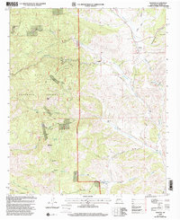
1999 Map of Winston
USGS Topo · Published 2002About this map
The mining legacies of the Black Range define this landscape, where the settlements of Winston and Chloride sit at the confluence of rugged canyons and high desert ridges. This 1999 revision of the Gila National Forest area documents an intense history of extraction, featuring dozens of named sites like the St Cloud Mines, Midnight Mine, and the U S Treasury Mine. Evidence of early territorial-era habitation remains through landmarks like Midnight Cabin and the Santo Niño Cemetery. The complex hydrology of the region is traced through the Cuchillo Negro Creek and Chloride Creek, which cut through terrain punctuated by peaks such as Hagins Peak and Way-Up Mountain. Ranching and mineral survey markers, including Monument 17 and Monument 18, provide specific points of reference for genealogists and surveyors tracking historical land claims in Sierra County.
Find a feature on this map
55 named features on this map. Tap any name to fly to it.
Don’t see what you’re looking for? This feature index may not catch every label — zoom into the map to look around manually.
Map Details
Editions of this 1999 Winston Map
This is the sole edition of this map. No revisions or reprints were ever made.
Other maps of this area

1949 · Lookout Mountain
USGS Topo · 1:62,500

1954 · Tularosa
USGS Topo · 1:250,000

1958 · Tularosa
USGS Topo · 1:250,000

1963 · Thumb Tank Peak
USGS Topo · 1:24,000

1963 · Reeds Peak
USGS Topo · 1:24,000

1963 · Sugarloaf Peak
USGS Topo · 1:24,000

1965 · Winston
USGS Topo · 1:24,000

1965 · Iron Mountain
USGS Topo · 1:24,000

1965 · Jaralosa Mountain
USGS Topo · 1:24,000
1965 · Chise
USGS Topo · 1:24,000