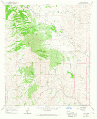
1965 Map of Chise
USGS Topo · Published 1967About this map
Sierra Cuchillo dominates this mid-1960s landscape, with its high ridges and deep canyons defining a region of remote mining and ranching operations. The small settlement of Chise lies along the banks of Cuchillo Negro Creek, where the waterway cuts through the southern portion of the quadrangle. This area reflects a mid-century economy built on livestock and mineral extraction, evidenced by the numerous isolated outposts like Rouse Camp and the L C Ranch.
Find a feature on this map
47 named features on this map. Tap any name to fly to it.
Don’t see what you’re looking for? This feature index may not catch every label — zoom into the map to look around manually.
Map Details
Editions of this 1965 Chise Map
2 editions found
Other maps of this area

1954 · Tularosa
USGS Topo · 1:250,000

1958 · Tularosa
USGS Topo · 1:250,000

1961 · Priest Tank
USGS Topo · 1:24,000

1961 · Williamsburg NW
USGS Topo · 1:24,000

1961 · Monticello
USGS Topo · 1:24,000

1963 · Thumb Tank Peak
USGS Topo · 1:24,000

1963 · Sugarloaf Peak
USGS Topo · 1:24,000

1965 · Winston
USGS Topo · 1:24,000

1965 · Iron Mountain
USGS Topo · 1:24,000

1965 · Jaralosa Mountain
USGS Topo · 1:24,000