
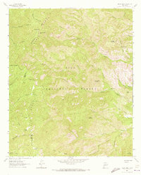
1963 Map of Reeds Peak
USGS Topo · Published 1965About this map
Continental Divide winds through the high ridges of the Black Range in this survey of the Gila National Forest during the early 1960s. The landscape is defined by isolated outposts and seasonal water sources, featuring Reeds Ranch and Whitmore Cabin situated along the rugged drainage systems. Significant elevation markers like Reeds Peak, topped with a Lookout Tower, and Moccasin John Mountain overlook a complex network of canyons including Deadman Canyon and Hickland Canyon. Water access is tracked through various improved points such as Upper Circle Seven Well and Curtis Well, while several spring-fed creeks like South Diamond Creek and the headwaters of the Mimbres River descend from the divide. The presence of the Pack Trail and Marshall Creek Trail suggests the area's ongoing reliance on primitive transportation routes for forest management and ranching.
Find a feature on this map
45 named features on this map. Tap any name to fly to it.
Don’t see what you’re looking for? This feature index may not catch every label — zoom into the map to look around manually.
Map Details
Editions of this 1963 Reeds Peak Map
2 editions found
Other maps of this area

1949 · Lookout Mountain
USGS Topo · 1:62,500

1954 · Tularosa
USGS Topo · 1:250,000

1958 · Tularosa
USGS Topo · 1:250,000

1963 · Bonner Canyon
USGS Topo · 1:24,000
1963 · Hay Mesa
USGS Topo · 1:24,000

1963 · Sugarloaf Peak
USGS Topo · 1:24,000

1963 · Victoria Park
USGS Topo · 1:24,000

1963 · Apache Peak
USGS Topo · 1:24,000

1965 · Winston
USGS Topo · 1:24,000

1979 · Truth or Consequences
USGS Topo · 1:100,000