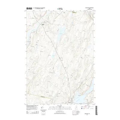
2014 Map of Wiscasset
USGS Topo · Published 2014About this map
The village of Wiscasset anchors the southeastern corner of this landscape, situated along the Sheepscot River and Cod Cove. Moving inland, the terrain is defined by a dense network of inland waters and small family-named cemeteries that speak to the long history of settlement in Lincoln County. Significant landmarks include the Dresden Bog Reservoir and Gardiner Pond, while the northwestern corner is marked by Dresden Mills near the banks of the Eastern River. For genealogists, the map is remarkably detailed, identifying over a dozen burial sites including Ancient Cem, Evergreen Cem, and Rhumrill Cem. These locations, many situated along rural routes like Gardiner Rd and Old Dresden Rd, offer a spatial record of the area's ancestral homesteads and established community centers.
Find a feature on this map
77 named features on this map. Tap any name to fly to it.
Don’t see what you’re looking for? This feature index may not catch every label — zoom into the map to look around manually.
Map Details
Editions of this 2014 Wiscasset Map
This is the sole edition of this map. No revisions or reprints were ever made.
Other maps of this area

1892 · Gardiner
USGS Topo · 1:62,500

1893 · Wiscasset
USGS Topo · 1:62,500

1893 · Boothbay
USGS Topo · 1:62,500

1894 · Bath
USGS Topo · 1:62,500

1920 · Bath
USGS Topo · 1:62,500

1941 · Boothbay
USGS Topo · 1:62,500

1943 · Gardiner
USGS Topo · 1:62,500

1943 · Boothbay
USGS Topo · 1:62,500

1944 · Wiscasset
USGS Topo · 1:62,500

1944 · Boothbay
USGS Topo · 1:62,500