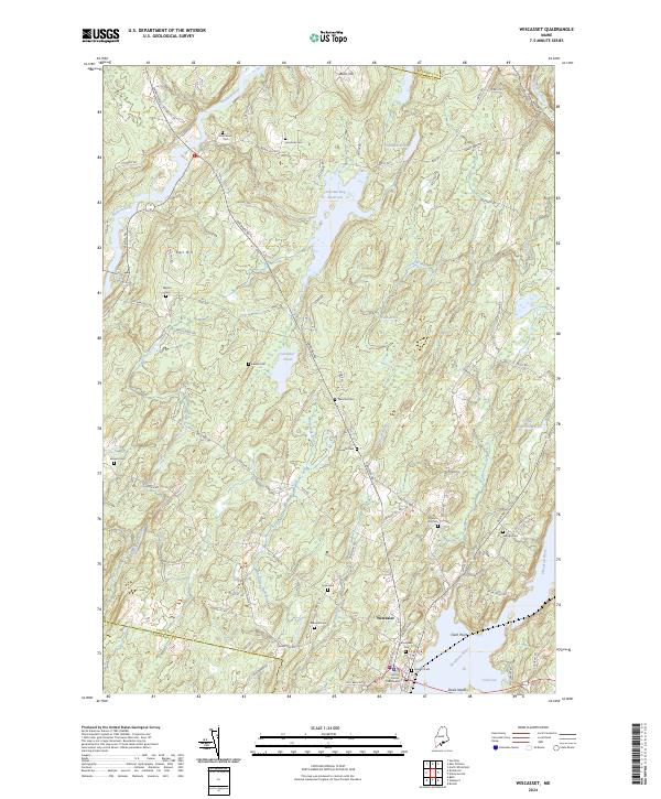
2024 Map of Wiscasset
USGS Topo · Published 2024About this map
The Lincoln County Courthouse anchors the historic village of Wiscasset, positioned along the banks of the Sheepscot River. This mid-coastal Maine landscape is defined by its deep maritime and colonial heritage, visible in the high density of small family burial grounds such as Ancient Cem, Huntoon Hill Cem, and Marston Cem scattered across the interior. The terrain transitions from the tidal waters of Cod Cove and Clark Point to the interior wetlands of Dresden Bog Reservoir. North of the village, the land rises toward Blinn Hill and Call Hill, while numerous brooks like Montsweag Brook and Ward Brook drain through the wooded hills. The map highlights a network of local roads including Gardiner Rd Weymouth Dr and Alna Rd, which connect the riverside settlements to the upland farms and historic marshes.
Find a feature on this map
83 named features on this map. Tap any name to fly to it.
Don’t see what you’re looking for? This feature index may not catch every label — zoom into the map to look around manually.
Map Details
Editions of this 2024 Wiscasset Map
This is the sole edition of this map. No revisions or reprints were ever made.
Other maps of this area

1892 · Gardiner
USGS Topo · 1:62,500

1893 · Wiscasset
USGS Topo · 1:62,500

1893 · Boothbay
USGS Topo · 1:62,500

1894 · Bath
USGS Topo · 1:62,500

1920 · Bath
USGS Topo · 1:62,500

1941 · Boothbay
USGS Topo · 1:62,500

1943 · Gardiner
USGS Topo · 1:62,500

1943 · Boothbay
USGS Topo · 1:62,500

1944 · Wiscasset
USGS Topo · 1:62,500

1944 · Boothbay
USGS Topo · 1:62,500