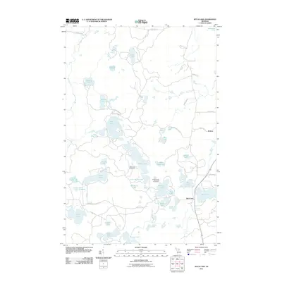
2011 Map of Witch Lake
USGS Topo · Published 2011About this map
Witch Lake and the small settlement of Witbeck serve as the primary landmarks in this water-rich corridor of the Upper Peninsula. The landscape is defined by an intricate network of glacial lakes and wetlands, connected by secondary roads such as County Hwy Lighthouse and the Yukon Trl. Public recreation is centered around the Squaw Lake State Forest Campground and the Horseshoe Lake State Forest Campground, indicating the area's modern role as a destination for outdoor enthusiasts. The abundance of named water bodies, including Chief Lake, Penglase Lake, and Fence Lake, suggests a region where geography is more often defined by shoreline than by town centers, reflecting the sparsely populated character of the north woods in the early twenty-first century.
Find a feature on this map
49 named features on this map. Tap any name to fly to it.
Don’t see what you’re looking for? This feature index may not catch every label — zoom into the map to look around manually.
Map Details
Editions of this 2011 Witch Lake Map
This is the sole edition of this map. No revisions or reprints were ever made.
Other maps of this area

1899 · Sagola
USGS Topo · 1:62,500

1899 · Witbeck
USGS Topo · 1:62,500

1947 · Kiernan
USGS Topo · 1:24,000

1955 · Witch Lake
USGS Topo · 1:24,000

1955 · Ralph NW
USGS Topo · 1:24,000

1955 · Witch Lake NE
USGS Topo · 1:24,000

1955 · Republic
USGS Topo · 1:62,500

1955 · Republic
USGS Topo · 1:24,000

1955 · Witch Lake
USGS Topo · 1:62,500

1955 · Republic SW
USGS Topo · 1:24,000