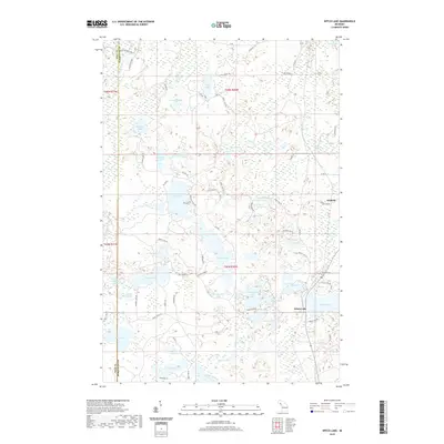
2019 Map of Witch Lake
USGS Topo · Published 2019About this map
The Michigan River flows along the western boundary of this landscape in the Upper Peninsula, marking the transition between Iron and Marquette counties. The area is defined by a dense concentration of glacial water bodies, with the settlement of Witch Lake and the nearby Witbeck serving as the primary points of habitation. The local road network, including Witch Lake Rd and Chief Lake Rd, provides access to numerous lakes such as Chief Lake, Sundog Lake, and Fence Lake. The map reveals a heavily wooded environment interlaced with specialized routes like the Little Moose Trl and Haywire Lake Rd. This intricate network of small lakes and seasonal drainages, such as Caps Cr and Squaw Creek, illustrates a northern wilderness shaped by water and logging access. For genealogists and local historians, these named features and lake-access roads provide a clear view of property boundaries and recreational settlements in this part of Michigan.
Find a feature on this map
79 named features on this map. Tap any name to fly to it.
Don’t see what you’re looking for? This feature index may not catch every label — zoom into the map to look around manually.
Map Details
Editions of this 2019 Witch Lake Map
This is the sole edition of this map. No revisions or reprints were ever made.
Other maps of this area

1899 · Sagola
USGS Topo · 1:62,500

1899 · Witbeck
USGS Topo · 1:62,500

1947 · Kiernan
USGS Topo · 1:24,000

1955 · Witch Lake
USGS Topo · 1:24,000

1955 · Ralph NW
USGS Topo · 1:24,000

1955 · Witch Lake NE
USGS Topo · 1:24,000

1955 · Republic
USGS Topo · 1:62,500

1955 · Republic
USGS Topo · 1:24,000

1955 · Witch Lake
USGS Topo · 1:62,500

1955 · Republic SW
USGS Topo · 1:24,000