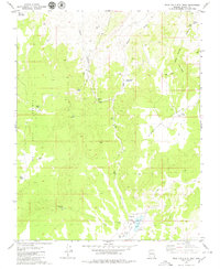
1979 Map of Wolf Hole Mtn. East
USGS Topo · Published 1979About this map
Wolf Hole (Site) sits at the southern reach of this Arizona strip landscape, representing a quiet hub of cattle ranching and seasonal water management in the late 1970s. The terrain is defined by the massive uplift of Wolf Hole Mountain and Seegmiller Mountain, where a network of livestock infrastructure connects various water sources. Important local landmarks include Wolf Hole Spring and Wolf Hole Lake, which drain into the Wolf Hole Valley. Further north, the landscape shifts toward Quail Flat and the Quail Draw Reservoir, supported by several remote springs such as Quail Spring and Oak Spring. Numerous corrals and a complex system of Jeep Trails snake through the canyons, illustrating the era's reliance on rugged vehicle access to maintain remote outposts like the Tub Pond and Middle Tank.
Find a feature on this map
27 named features on this map. Tap any name to fly to it.
Don’t see what you’re looking for? This feature index may not catch every label — zoom into the map to look around manually.
Map Details
Editions of this 1979 Wolf Hole Mtn. East Map
This is the sole edition of this map. No revisions or reprints were ever made.
Other maps of this area

1886 · Mt. Trumbull
USGS Topo · 1:250,000

1892 · Mt. Trumbull
USGS Topo · 1:250,000

1953 · Grand Canyon
USGS Topo · 1:250,000

1954 · Hurricane Cliffs 2 NW
USGS Topo · 1:24,000

1954 · Wolf Hole Mtn. NW
USGS Topo · 1:24,000

1954 · Wolf Hole Mtn. NE
USGS Topo · 1:24,000

1957 · Grand Canyon
USGS Topo · 1:250,000

1958 · Grand Canyon
USGS Topo · 1:250,000

1960 · Grand Canyon
USGS Topo · 1:250,000
1979 · Sullivan Draw North
USGS Topo · 1:24,000