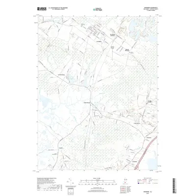
2019 Map of Woodbine
USGS Topo · Published 2019About this map
Woodbine serves as a focal point for this section of Cape May County, displaying a grid of streets named for presidents and early local figures. The area's cultural history is deeply marked by its cemeteries, including the Tiffereth Israel Cem and United Brotherhood Cem, which speak to the diverse communities that settled here. To the east, the landscape transitions into the Great Cedar Swamp and Timber and Beaver Swamp, illustrating the persistent wetland character of the Jersey Cape. Small communities like Goshen and South Dennis are connected by historical corridors such as the Court House South Dennis Rd, while evidence of old industries remains visible at Old Bogs and Clint Millpond. The presence of Woodbine Junction and the Woodbine Municipal Airport highlights the region's evolution from a rail-dependent settlement to a modern intersection of transport and commerce.
Find a feature on this map
134 named features on this map. Tap any name to fly to it.
Don’t see what you’re looking for? This feature index may not catch every label — zoom into the map to look around manually.
Map Details
Editions of this 2019 Woodbine Map
This is the sole edition of this map. No revisions or reprints were ever made.
Other maps of this area

1884 · Sea Isle
USGS Topo · 1:62,500

1888 · Dennisville
USGS Topo · 1:62,500

1888 · Sea Isle
USGS Topo · 1:62,500

1890 · Great Egg Harbor
USGS Topo · 1:62,500

1890 · Tuckahoe
USGS Topo · 1:62,500

1893 · Great Egg Harbor
USGS Topo · 1:62,500

1893 · Tuckahoe
USGS Topo · 1:62,500

1894 · Dennisville
USGS Topo · 1:62,500

1894 · Sea Isle
USGS Topo · 1:62,500

1918 · Great Egg Harbor
USGS Topo · 1:62,500
Featured Places
- Middle Township, NJ
- Upper Township, NJ
- Woodbine, NJ
- Cedar Grove, Dennis Township
- South Seaville, Dennis Township