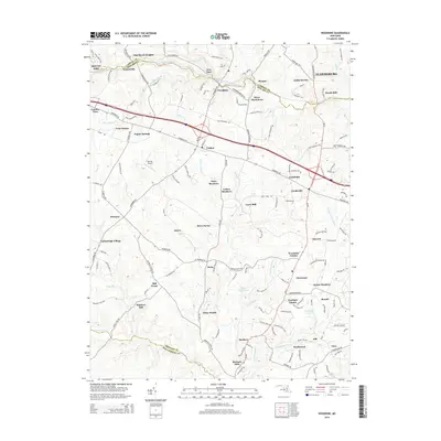
2014 Map of Woodbine
USGS Topo · Published 2014About this map
Lisbon and Cooksville anchor the central portion of this Howard County landscape, where the legacy of early milling and rural industry is clearly visible in surviving place names. The topography is defined by the winding paths of the South Branch Patapsco River to the north and the Patuxent River to the south, creating a corridor of interconnected settlements like Woodbine and Morgan. This 2014 survey documents the transition of traditionally agricultural lands into residential enclaves, such as River Plantations and Woodside Estates, while maintaining a high density of historically significant sites like Hoods Mill, Carrs Mill, and Hipsleys Mill. The map also captures local infrastructure like Barnes Airport and the thoroughfare of Frederick Rd, illustrating how modern connectivity has integrated with the area's established network of villages and water-powered landmarks.
Find a feature on this map
153 named features on this map. Tap any name to fly to it.
Don’t see what you’re looking for? This feature index may not catch every label — zoom into the map to look around manually.
Map Details
Editions of this 2014 Woodbine Map
This is the sole edition of this map. No revisions or reprints were ever made.
Other maps of this area

1892 · Laurel
USGS Topo · 1:62,500

1892 · Ellicott
USGS Topo · 1:62,500

1893 · Frederick
USGS Topo · 1:125,000

1894 · Ellicott
USGS Topo · 1:62,500

1894 · Laurel
USGS Topo · 1:62,500

1894 · Frederick
USGS Topo · 1:125,000

1897 · Laurel
USGS Topo · 1:62,500

1906 · Ellicott
USGS Topo · 1:62,500

1907 · Laurel
USGS Topo · 1:62,500

1908 · Patapsco
USGS Topo · 1:125,000