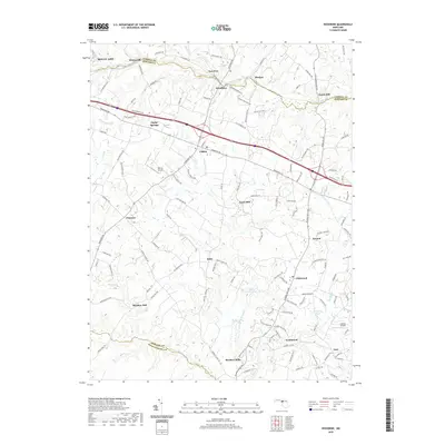
2019 Map of Woodbine
USGS Topo · Published 2019About this map
The S Br Patapsco River and the Patuxent River define the northern and southern drainage of this Piedmont landscape, which sits at the meeting point of Howard, Carroll, and Montgomery counties. Historically significant milling sites are distributed along these waterways, including Hoods Mill, Carrs Mill, Hipsleys Mill, and Roxbury Mills, reflecting the region's agricultural and industrial heritage. The central corridor is dominated by the transit path of Lisbon and Poplar Springs, where local road networks like Frederick Rd intersect older township markers. The terrain is a network of small tributaries such as Cattail Cr and Lisbons Little Cr feeding into larger river systems. While modern development is visible near Glenwood and Inwood, the map preserves the location of traditional settlements like Watersville and Daisy and water features like Warfields Pond, offering a view of the area's rural character and long-standing property divisions.
Find a feature on this map
127 named features on this map. Tap any name to fly to it.
Don’t see what you’re looking for? This feature index may not catch every label — zoom into the map to look around manually.
Map Details
Editions of this 2019 Woodbine Map
This is the sole edition of this map. No revisions or reprints were ever made.
Other maps of this area

1892 · Laurel
USGS Topo · 1:62,500

1892 · Ellicott
USGS Topo · 1:62,500

1893 · Frederick
USGS Topo · 1:125,000

1894 · Ellicott
USGS Topo · 1:62,500

1894 · Laurel
USGS Topo · 1:62,500

1894 · Frederick
USGS Topo · 1:125,000

1897 · Laurel
USGS Topo · 1:62,500

1906 · Ellicott
USGS Topo · 1:62,500

1907 · Laurel
USGS Topo · 1:62,500

1908 · Patapsco
USGS Topo · 1:125,000