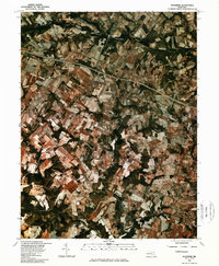
1981 Map of Woodbine
USGS Topo · Published 1986About this map
The South Branch Patapsco River defines the northern reaches of this Howard County landscape, captured in a 1981 orthophotographic study. This hybrid imagery, produced in cooperation with the Soil Conservation Service, reveals a dense mosaic of agricultural fields and woodlots at the start of the 1980s. The settlement of Lisbon sits centrally along the east-west corridor, serving as a primary local node alongside Poplar Springs. To the south, the terrain is shaped by the drainage of Cattail Creek, while the Patuxent River cuts through the southwestern corner. These aerial views provide a precise look at property boundaries and land use patterns near Woodbine and the small crossroads of Daisy, documenting the rural character of the region before further suburban expansion altered the traditional farming footprint.
Find a feature on this map
7 named features on this map. Tap any name to fly to it.
Don’t see what you’re looking for? This feature index may not catch every label — zoom into the map to look around manually.
Map Details
Editions of this 1981 Woodbine Map
This is the sole edition of this map. No revisions or reprints were ever made.
Other maps of this area

1892 · Laurel
USGS Topo · 1:62,500

1892 · Ellicott
USGS Topo · 1:62,500

1893 · Frederick
USGS Topo · 1:125,000

1894 · Ellicott
USGS Topo · 1:62,500

1894 · Laurel
USGS Topo · 1:62,500

1894 · Frederick
USGS Topo · 1:125,000

1897 · Laurel
USGS Topo · 1:62,500

1906 · Ellicott
USGS Topo · 1:62,500

1907 · Laurel
USGS Topo · 1:62,500

1908 · Patapsco
USGS Topo · 1:125,000