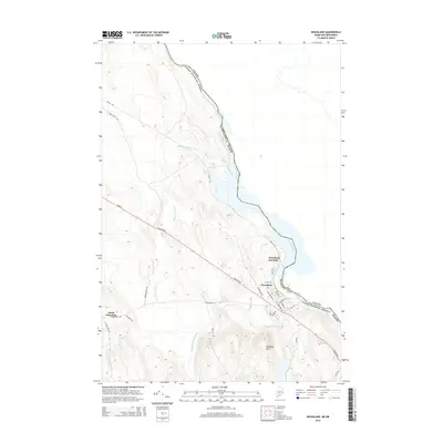
2014 Map of Woodland
USGS Topo · Published 2014About this map
The St. Croix River forms the international boundary with Canada, defining the eastern edge of this Washington County landscape. The settlement of Woodland sits near the riverbank, served by a network of local streets including Washington St and Hillside St. Northwest of the main village, Woodland Junction marks a secondary node of activity along the regional transport corridor. The terrain is characterized by a series of low peaks and watercourses, most notably Chapman Mtn in the south and the winding path of Wapsaconhagan Brook. In the west, the crossroads at South Princeton connects the area toward the interior via Houlton Rd. This survey captures the rural character of eastern Maine, where secondary routes like Grand Falls Rd and Robb Hill Rd navigate around prominent wetland features such as Sprague Meadow Brook.
Find a feature on this map
30 named features on this map. Tap any name to fly to it.
Don’t see what you’re looking for? This feature index may not catch every label — zoom into the map to look around manually.
Map Details
Editions of this 2014 Woodland Map
This is the sole edition of this map. No revisions or reprints were ever made.
Other maps of this area

1929 · Calais
USGS Topo · 1:48,000

1932 · Calais
USGS Topo · 1:62,500

1940 · Waite
USGS Topo · 1:62,500

1940 · Kellyland
USGS Topo · 1:62,500

1941 · Big Lake
USGS Topo · 1:62,500

1942 · Kellyland
USGS Topo · 1:62,500

1942 · Waite
USGS Topo · 1:62,500

1943 · Big Lake
USGS Topo · 1:62,500

1949 · Calais
USGS Topo · 1:24,000

1952 · Big Lake
USGS Topo · 1:50,000