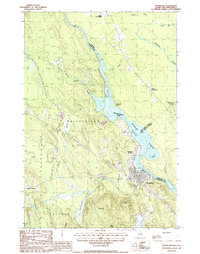
1987 Map of Woodland
USGS Topo · Published 1987About this map
The St Croix River defines the international boundary between Maine and New Brunswick in this 1980s landscape, serving as the central artery for the region's industry and settlement. Concentrated around the river's edge, the town of Woodland and nearby Woodland Junction highlight a community shaped by the water, featuring a Power House and Substation that supported the local economy. The surrounding terrain of Baileyville is characterized by complex hydrography, where Woodland Flowage and Hanson Cove meet an intricate network of waterways including Wapsaconhagan Brook and Meadow Brook. To the south, the elevations of Chapman Mtn and Robb Hill overlook the basin, while scattered Gravel Pits indicate active resource extraction near South Princeton. This survey preserves the precise alignment of the borderlands just before the close of the twentieth century, noting rural clusters like Upper Little Ridge and Lower Little Ridge.
Find a feature on this map
29 named features on this map. Tap any name to fly to it.
Don’t see what you’re looking for? This feature index may not catch every label — zoom into the map to look around manually.
Map Details
Editions of this 1987 Woodland Map
This is the sole edition of this map. No revisions or reprints were ever made.
Other maps of this area

1929 · Calais
USGS Topo · 1:48,000

1932 · Calais
USGS Topo · 1:62,500

1940 · Waite
USGS Topo · 1:62,500

1940 · Kellyland
USGS Topo · 1:62,500

1941 · Big Lake
USGS Topo · 1:62,500

1942 · Kellyland
USGS Topo · 1:62,500

1942 · Waite
USGS Topo · 1:62,500

1943 · Big Lake
USGS Topo · 1:62,500

1949 · Calais
USGS Topo · 1:24,000

1952 · Big Lake
USGS Topo · 1:50,000