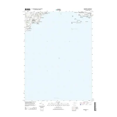
2015 Map of Woodmont
USGS Topo · Published 2015About this map
Lighthouse Point and the hazardous rock formations of Long Island Sound dominate this coastal survey of the Connecticut shoreline near New Haven. The map details the intricate residential street grids and shorefront communities that define the region, including West Shore and the borough of Woodmont. Along the water, a succession of named beaches such as Prospect Beach, Shell Beach, and Silver Sands Beach illustrate the area's long-standing character as a maritime destination. Inland, the landscape is shaped by rising terrain like Jones Hill and the drainage of the Oyster River. Offshore features like Quixes Ledge, Adams Fall, and South West Ledge indicate the complex navigation required to enter the New Haven Harbor Entrance Channel. This document provides a precise record of the developed coastline from Milford to Momauguin during the mid-2010s.
Find a feature on this map
71 named features on this map. Tap any name to fly to it.
Don’t see what you’re looking for? This feature index may not catch every label — zoom into the map to look around manually.
Map Details
Editions of this 2015 Woodmont Map
This is the sole edition of this map. No revisions or reprints were ever made.
Other maps of this area

1889 · Derby
USGS Topo · 1:62,500

1891 · Bridgeport
USGS Topo · 1:62,500

1891 · Derby
USGS Topo · 1:62,500

1892 · New Haven
USGS Topo · 1:62,500

1893 · Bridgeport
USGS Topo · 1:62,500

1893 · Derby
USGS Topo · 1:62,500

1920 · Bridgeport
USGS Topo · 1:62,500

1921 · New Haven
USGS Topo · 1:62,500

1943 · New Haven
USGS Topo · 1:31,680

1947 · Hartford
USGS Topo · 1:250,000