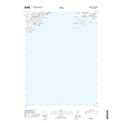
2018 Map of Woodmont
USGS Topo · Published 2018About this map
New Haven Harbor and the New Haven Harbor Entrance Channel dominate this coastal survey, where the urban reaches of New Haven and West Haven meet the Long Island Sound. The shoreline is characterized by a dense sequence of residential developments and recreational waterfronts, including West Shore, Woodmont, and Momauguin. This modern era map reveals a highly structured maritime landscape, with the Intracoastal Waterway cutting through the southern waters and numerous navigational hazards like Quixes Ledge and Old Head Reef marking the approach to the harbor. Landside, the terrain is defined by named rises such as Jones Hill and public landmarks like Lighthouse Point, while the Oyster River provides a natural boundary between municipalities. The map documents the extensive road network of the late 2010s, from Benham Hill Rd to Seaview Ave, reflecting the high-density suburban character of the South Central Connecticut Planning Region.
Find a feature on this map
63 named features on this map. Tap any name to fly to it.
Don’t see what you’re looking for? This feature index may not catch every label — zoom into the map to look around manually.
Map Details
Editions of this 2018 Woodmont Map
This is the sole edition of this map. No revisions or reprints were ever made.
Other maps of this area

1889 · Derby
USGS Topo · 1:62,500

1891 · Bridgeport
USGS Topo · 1:62,500

1891 · Derby
USGS Topo · 1:62,500

1892 · New Haven
USGS Topo · 1:62,500

1893 · Bridgeport
USGS Topo · 1:62,500

1893 · Derby
USGS Topo · 1:62,500

1920 · Bridgeport
USGS Topo · 1:62,500

1921 · New Haven
USGS Topo · 1:62,500

1943 · New Haven
USGS Topo · 1:31,680

1947 · Hartford
USGS Topo · 1:250,000