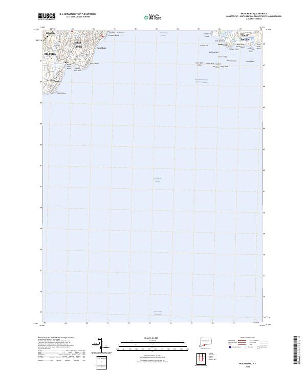
2024 Map of Woodmont
USGS Topo · Published 2024About this map
Woodmont and West Shore define this coastal stretch of Connecticut where the land meets the expansive Long Island Sound. The shoreline is a complex network of points and beaches, extending from Merwin Point in the west through Prospect Beach and toward the mouth of New Haven Harbor. High points like Jones Hill overlook the residential street grids of Orange and Milford, while the maritime environment is dominated by navigation-critical features including the New Haven Harbor Entrance Channel and the Intracoastal Waterway.
Find a feature on this map
64 named features on this map. Tap any name to fly to it.
Don’t see what you’re looking for? This feature index may not catch every label — zoom into the map to look around manually.
Map Details
Editions of this 2024 Woodmont Map
This is the sole edition of this map. No revisions or reprints were ever made.
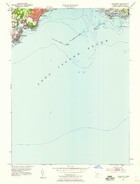
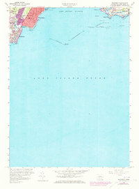
Historical Maps of Milford Through Time
3 maps found