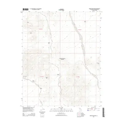
2015 Map of Woods Mountains
USGS Topo · Published 2015About this map
The Mojave National Preserve dominates this high-desert landscape in San Bernardino County, defined by the stark peaks of the Woods Mountains and Tortoise Shell Mtn. The terrain is characterized by a network of seasonal drainages, including Woods Wash, Watson Wash, and the prominent Black Canyon Wash, which carve through the arid topography. High-altitude landmarks like Table Top and Twin Buttes provide vertical relief above the spreading Lanfair Valley in the northeast. This 2015 survey illustrates the preserved state of the Mojave Desert wilderness, tracing the rugged corridors of Rustler Canyon and Grass Canyon. To the east, the map marks Hackberry Mtn and the isolated Ford Lake, showing the geological complexity of this protected corner of California near the turn of the century.
Find a feature on this map
19 named features on this map. Tap any name to fly to it.
Don’t see what you’re looking for? This feature index may not catch every label — zoom into the map to look around manually.
Map Details
Editions of this 2015 Woods Mountains Map
This is the sole edition of this map. No revisions or reprints were ever made.
Other maps of this area

1910 · Ivanpah
USGS Topo · 1:250,000

1912 · Ivanpah
USGS Topo · 1:250,000

1942 · Ivanpah
USGS Topo · 1:250,000

1942 · Amboy
USGS Topo · 1:250,000

1943 · Amboy
USGS Topo · 1:250,000

1943 · Fenner
USGS Topo · 1:62,500

1947 · Kingman
USGS Topo · 1:250,000

1948 · Kingman
USGS Topo · 1:250,000

1954 · Needles
USGS Topo · 1:250,000

1954 · Kingman
USGS Topo · 1:250,000