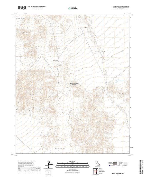
2021 Map of Woods Mountains
USGS Topo · Published 2021About this map
The Mojave National Preserve encompasses most of this 2021 landscape, a high-desert environment defined by dramatic topographic relief and wide, arid basins. The Woods Mountains and prominent peaks like Tortoise Shell Mtn and Hackberry Mtn dominate the central and southern portions of the sheet, while several distinct valleys provide a sense of the region's vast hydrography. The land is carved by numerous drainages, including Rustler Canyon, Grass Canyon, and Burro Canyon, which flow toward the lower elevations of Fenner Valley and Lanfair Valley.
Find a feature on this map
19 named features on this map. Tap any name to fly to it.
Don’t see what you’re looking for? This feature index may not catch every label — zoom into the map to look around manually.
Map Details
Editions of this 2021 Woods Mountains Map
This is the sole edition of this map. No revisions or reprints were ever made.
Other maps of this area

1910 · Ivanpah
USGS Topo · 1:250,000

1912 · Ivanpah
USGS Topo · 1:250,000

1942 · Ivanpah
USGS Topo · 1:250,000

1942 · Amboy
USGS Topo · 1:250,000

1943 · Amboy
USGS Topo · 1:250,000

1943 · Fenner
USGS Topo · 1:62,500

1947 · Kingman
USGS Topo · 1:250,000

1948 · Kingman
USGS Topo · 1:250,000

1954 · Needles
USGS Topo · 1:250,000

1954 · Kingman
USGS Topo · 1:250,000