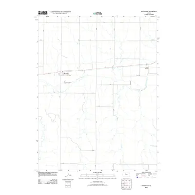
2012 Map of Woodston
USGS Topo · Published 2012About this map
The town of Woodston anchors this rural landscape along the winding path of the S Fork Solomon River. Situated in Rooks County, this agricultural region is defined by a grid of local section roads, including F Rd and W 130th Dr, which connect scattered farms to the municipal center. The map reveals the local infrastructure essential to the community's survival, from the central Po on Elm St to the modern Woodston Wastewater Treatment Facility south of the river. To the east, the Pleasant Valley Cem stands near the river's edge, offering a point of interest for genealogical research. The terrain is marked by several seasonal and permanent watercourses, such as Medicine Cr and Lucky Cr, which drain the surrounding plains and shape the local topography.
Find a feature on this map
28 named features on this map. Tap any name to fly to it.
Don’t see what you’re looking for? This feature index may not catch every label — zoom into the map to look around manually.
Map Details
Editions of this 2012 Woodston Map
This is the sole edition of this map. No revisions or reprints were ever made.
Other maps of this area

1893 · Smith Center
USGS Topo · 1:125,000

1893 · Phillipsburg
USGS Topo · 1:125,000

1896 · Osborne
USGS Topo · 1:125,000

1896 · Plainville
USGS Topo · 1:125,000

1953 · Woodston NW
USGS Topo · 1:24,000

1953 · Woodston
USGS Topo · 1:24,000

1953 · Alton
USGS Topo · 1:24,000

1955 · Beloit
USGS Topo · 1:250,000

1959 · Beloit
USGS Topo · 1:250,000

1961 · Kirwin SE
USGS Topo · 1:24,000