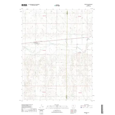
2018 Map of Woodston
USGS Topo · Published 2018About this map
Woodston serves as the central community in this western Kansas landscape, situated where the high plains meet the valley of the S Fork Solomon River. The town's grid, including Main St, Penn St, and Spruce St, reflects a traditional agricultural layout oriented toward the railway corridor and Elevator Rd. This area is defined by the sharp transition between the flat river bottoms and the highly dissected uplands to the south, where drainage systems like Lucky Cr and Medicine Cr have carved intricate coulees into the prairie. The county line between Rooks Co and Osborne Co runs vertically through the center of the survey, a political boundary that bisects the rolling agricultural tracts. In the eastern portion of the map, the Pleasant Valley Cem provides a point of genealogical interest, marking the site of a rural congregation or early settlement node in Osborne County.
Find a feature on this map
38 named features on this map. Tap any name to fly to it.
Don’t see what you’re looking for? This feature index may not catch every label — zoom into the map to look around manually.
Map Details
Editions of this 2018 Woodston Map
This is the sole edition of this map. No revisions or reprints were ever made.
Other maps of this area

1893 · Smith Center
USGS Topo · 1:125,000

1893 · Phillipsburg
USGS Topo · 1:125,000

1896 · Osborne
USGS Topo · 1:125,000

1896 · Plainville
USGS Topo · 1:125,000

1953 · Woodston NW
USGS Topo · 1:24,000

1953 · Woodston
USGS Topo · 1:24,000

1953 · Alton
USGS Topo · 1:24,000

1955 · Beloit
USGS Topo · 1:250,000

1959 · Beloit
USGS Topo · 1:250,000

1961 · Kirwin SE
USGS Topo · 1:24,000