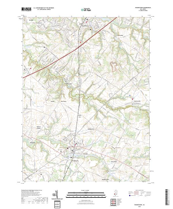
2023 Map of Woodstown
USGS Topo · Published 2023About this map
Woodstown serves as a significant hub within this region where the Gloucester and Salem county lines meet. The landscape is defined by the winding paths of Oldmans Creek and the Salem River, which supported early industry at sites like Porches Mill and Avis Millpond. Genealogists will find this area particularly noteworthy for its high concentration of historic burial sites, ranging from the Friends Burying Ground and Lawnside Cem in the south to the Jordantown Cem and Ebenezer Cem further north. The settlement pattern follows a network of historic transit routes, including N J Route 45 and the Pole Tavern Woodstown Rd. Smaller hamlets such as Harrisonville, Auburn, and Sharptown remain connected by these corridors, while the presence of the Stallone Airport and Var-Sky Airport highlights the continued utility of the open terrain east of Eldridge Hill.
Find a feature on this map
79 named features on this map. Tap any name to fly to it.
Don’t see what you’re looking for? This feature index may not catch every label — zoom into the map to look around manually.
Map Details
Editions of this 2023 Woodstown Map
This is the sole edition of this map. No revisions or reprints were ever made.
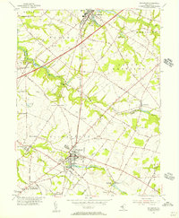
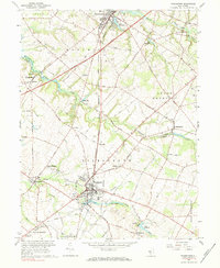
Historical Maps of Union Grove Through Time
3 maps found