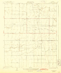
1928 Map of Woodville
USGS Topo · Published 1943About this map
Agricultural development across the Tulare County floor is clearly visible in this survey, defined by a grid of rural roads and an extensive irrigation network. The Tule River and Mitchell Slough provide the natural drainage, but the landscape is increasingly shaped by man-made water works like the Stockton Ditch, Wood Center Ditch, and Poplar Ditch. Small centers of community life are anchored by the settlements of Woodville and Poplar, while a remarkably dense distribution of rural education sites—including Surprise School, Harmony School, Vincent School, and Pleasant View School—points to the established family farming culture of the late 1920s. Industrial infrastructure is also present, marked by the Southern California RR corridor and a prominent Edison Power Line cutting north-south through the valley, illustrating the electrification and transport requirements of this growing interior region.
Find a feature on this map
17 named features on this map. Tap any name to fly to it.
Don’t see what you’re looking for? This feature index may not catch every label — zoom into the map to look around manually.
Map Details
Editions of this 1928 Woodville Map
3 editions found
Other maps of this area

1925 · Tulare
USGS Topo · 1:31,680

1925 · Tipton
USGS Topo · 1:31,680

1927 · Cairns Corner
USGS Topo · 1:31,680

1927 · Tulare
USGS Topo · 1:31,680

1928 · Tipton
USGS Topo · 1:31,680

1928 · Woodville
USGS Topo · 1:31,680

1928 · Lindsay
USGS Topo · 1:31,680

1929 · Sausalito School
USGS Topo · 1:31,680

1929 · Porterville
USGS Topo · 1:31,680

1929 · Pixley
USGS Topo · 1:31,680