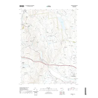
2021 Map of Woronoco
USGS Topo · Published 2021About this map
Tekoa Mtn and Pochassic Hills dominate the rugged landscape northwest of Westfield in this modern survey. The Westfield River carves a deep valley through the center of the sheet, where the industrial settlement of Woronoco is situated alongside the river's winding path. This area is defined by its significant water resources, including the expansive Tighe Carmody Reservoir and the Westfield Reservoir, which serve the surrounding population centers.
Find a feature on this map
154 named features on this map. Tap any name to fly to it.
Don’t see what you’re looking for? This feature index may not catch every label — zoom into the map to look around manually.
Map Details
Editions of this 2021 Woronoco Map
This is the sole edition of this map. No revisions or reprints were ever made.
Other maps of this area

1885 · Northampton
USGS Topo · 1:62,500

1886 · Springfield
USGS Topo · 1:62,500

1886 · Chesterfield
USGS Topo · 1:62,500

1886 · Northampton
USGS Topo · 1:62,500

1887 · Granville
USGS Topo · 1:62,500

1888 · Chesterfield
USGS Topo · 1:62,500

1889 · Springfield
USGS Topo · 1:62,500

1889 · Granville
USGS Topo · 1:62,500

1891 · Northampton
USGS Topo · 1:62,500

1893 · Northampton
USGS Topo · 1:62,500