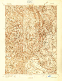
1937 Map of Woronoco
USGS Topo · Published 1937About this map
Woronoco and the surrounding river valley reveal a landscape defined by industry and early transportation corridors in the late 1930s. The Westfield River carves through the center of this map, paralleled by the Boston and Albany Railroad and an Abandoned Canal, indicating the evolution of commerce through the Pioneer Valley. Higher elevations are marked by the Westfield Marble Quarries and several small reservoirs, including the Westfield Upper Reservoir and Tekoa Reservoir, which supported the downstream settlements.
Find a feature on this map
62 named features on this map. Tap any name to fly to it.
Don’t see what you’re looking for? This feature index may not catch every label — zoom into the map to look around manually.
Map Details
Editions of this 1937 Woronoco Map
This is the sole edition of this map. No revisions or reprints were ever made.
Other maps of this area

1885 · Northampton
USGS Topo · 1:62,500

1886 · Springfield
USGS Topo · 1:62,500

1886 · Chesterfield
USGS Topo · 1:62,500

1886 · Northampton
USGS Topo · 1:62,500

1887 · Granville
USGS Topo · 1:62,500

1888 · Chesterfield
USGS Topo · 1:62,500

1889 · Springfield
USGS Topo · 1:62,500

1889 · Granville
USGS Topo · 1:62,500

1891 · Northampton
USGS Topo · 1:62,500

1893 · Northampton
USGS Topo · 1:62,500