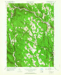
1956 Map of Worthington
USGS Topo · Published 1964About this map
West Worthington and the surrounding Hill Towns of Hampshire County are defined by a complex network of tributaries feeding the various branches of the Westfield River. During this mid-century period, the landscape transitioned from small, concentrated village centers like Worthington Corners and Worthington Center into larger protected tracts of land. The establishment of the Worthington State Forest and Deer Hill State Reservation signifies a shift toward conservation and public recreation.
Find a feature on this map
69 named features on this map. Tap any name to fly to it.
Don’t see what you’re looking for? This feature index may not catch every label — zoom into the map to look around manually.
Map Details
Editions of this 1956 Worthington Map
2 editions found
Other maps of this area

1886 · Greylock
USGS Topo · 1:62,500

1886 · Hawley
USGS Topo · 1:62,500

1886 · Chesterfield
USGS Topo · 1:62,500

1886 · Becket
USGS Topo · 1:62,500

1888 · Becket
USGS Topo · 1:62,500

1888 · Chesterfield
USGS Topo · 1:62,500

1890 · Hawley
USGS Topo · 1:62,500

1891 · Greylock
USGS Topo · 1:62,500

1893 · Chesterfield
USGS Topo · 1:62,500

1893 · Becket
USGS Topo · 1:62,500