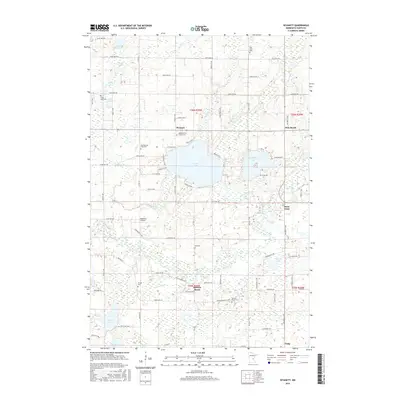
2016 Map of Wyanett
USGS Topo · Published 2016About this map
Green Lake and Spectacle Lake dominate the central landscape of this Isanti County region, where glacial geography has created a dense network of wetlands and small water bodies. The settlement pattern is defined by rural clusters such as Wyanett and Spencer Brook, linked by a grid of county roads and avenues like Co Rd 7 and 357th Ave NW. For family historians, the area is notable for its numerous burial grounds, including the Old Wyanett Free Cem and King Cem, which reflect the early pioneers who established these lakeside communities. The winding course of the Rum River cuts through the southern portion of the map, while Cameron's Airport provides a modern navigational landmark amidst the traditional farmsteads and wooded reaches that characterize this part of Minnesota.
Find a feature on this map
84 named features on this map. Tap any name to fly to it.
Don’t see what you’re looking for? This feature index may not catch every label — zoom into the map to look around manually.
Map Details
Editions of this 2016 Wyanett Map
This is the sole edition of this map. No revisions or reprints were ever made.
Other maps of this area

1916 · St. Francis
USGS Topo · 1:62,500

1919 · St. Francis
USGS Topo · 1:62,500

1953 · Stillwater
USGS Topo · 1:250,000

1955 · Stillwater
USGS Topo · 1:250,000

1958 · Stillwater
USGS Topo · 1:250,000

1961 · Bradford
USGS Topo · 1:24,000

1961 · Lake Fremont
USGS Topo · 1:24,000

1961 · Springvale
USGS Topo · 1:24,000

1961 · Dalbo
USGS Topo · 1:24,000

1961 · Wyanett
USGS Topo · 1:24,000