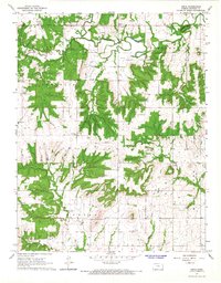
1966 Map of Xenia
USGS Topo · Published 1967About this map
The Little Osage River winds across this Bourbon County landscape, defining the topography alongside prominent elevations like Guthrie Mtn. The 1960s economy in this part of Kansas is anchored by the extensive Gas Field and scattered Quarries, while the small community of Xenia serves as the local hub. Cultural markers of the era's rural life are evident in the presence of the Dry Ridge Ch and several burial grounds, including Northway Cem and Morris Cem. To the southeast, the settlement of Berlin sits near the banks of Mill Creek, where the terrain transitions toward more concentrated drainage networks like Turkey Creek and Opossum Hollow. The network of unimproved roads and township lines reveals a pattern of land use dictated by the meandering waterways of Limestone Creek and Tippie Creek.
Find a feature on this map
25 named features on this map. Tap any name to fly to it.
Don’t see what you’re looking for? This feature index may not catch every label — zoom into the map to look around manually.
Map Details
Editions of this 1966 Xenia Map
This is the sole edition of this map. No revisions or reprints were ever made.
Other maps of this area

1884 · Fort Scott
USGS Topo · 1:125,000

1885 · Garnett
USGS Topo · 1:125,000

1886 · Iola
USGS Topo · 1:125,000

1886 · Fort Scott
USGS Topo · 1:125,000

1887 · Mound City
USGS Topo · 1:125,000

1893 · Fort Scott
USGS Topo · 1:125,000

1893 · Iola
USGS Topo · 1:125,000

1893 · Mound City
USGS Topo · 1:125,000

1894 · Garnett
USGS Topo · 1:125,000

1904 · Iola
USGS Topo · 1:125,000