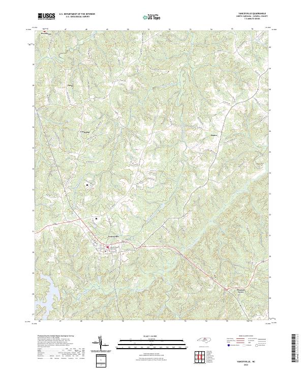
2022 Map of Yanceyville
USGS Topo · Published 2022About this map
Yanceyville serves as the focal point of this Caswell County landscape, centered on the historic Caswell County Courthouse. The town is the junction for several local routes including West Main Street and East Main Street, reflecting its role as a regional hub. To the southeast, the small settlement of Pleasant Grove marks the transition into more rural agricultural lands. The terrain is deeply dissected by a dense hydrological network, primarily the various branches of the Rattlesnake Creek system and the winding Country Line Creek. Smaller communities like Purley, Covington, and Hamer are scattered across the uplands, connected by a web of family-named roads such as Hatchett Road and Moorefield Road. This survey documents the contemporary rural character of the North Carolina Piedmont, where modern developments like Lake Pointe Drive interface with long-standing crossroads settlements.
Find a feature on this map
84 named features on this map. Tap any name to fly to it.
Don’t see what you’re looking for? This feature index may not catch every label — zoom into the map to look around manually.
Map Details
Editions of this 2022 Yanceyville Map
This is the sole edition of this map. No revisions or reprints were ever made.
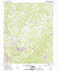
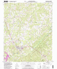
Historical Maps of Yanceyville Through Time
3 maps found