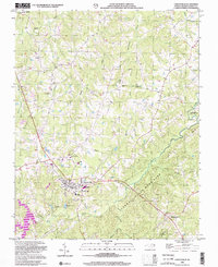
2002 Map of Yanceyville
USGS Topo · Published 2002About this map
Yanceyville serves as the focal point of this Caswell County survey, showing a landscape defined by rural crossroads and the winding tributaries of the Dan River watershed. Educational and civic sites are concentrated here, including Yancey High Sch, Dillard Jr High Sch, and the local Fairgrounds. The mapping highlights several small communities such as Providence, Purley, and Pleasant Grove, each anchored by historical institutions like Providence Ch and Sassafras Grove Ch.
Find a feature on this map
30 named features on this map. Tap any name to fly to it.
Don’t see what you’re looking for? This feature index may not catch every label — zoom into the map to look around manually.
Map Details
Editions of this 2002 Yanceyville Map
This is the sole edition of this map. No revisions or reprints were ever made.
Other maps of this area

1923 · Danville
USGS Topo · 1:48,000

1925 · Danville
USGS Topo · 1:62,500

1952 · Milton
USGS Topo · 1:62,500

1953 · Greensboro
USGS Topo · 1:250,000

1954 · Greensboro
USGS Topo · 1:250,000

1956 · Milton
USGS Topo · 1:62,500

1962 · Greensboro
USGS Topo · 1:250,000

1965 · Danville
USGS Topo · 1:24,000

1965 · Ringgold
USGS Topo · 1:24,000

1966 · Greensboro
USGS Topo · 1:250,000