2024 Map of Yankeetown
USGS Topo · Published 2024About this map
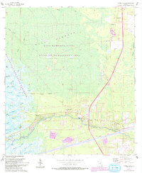
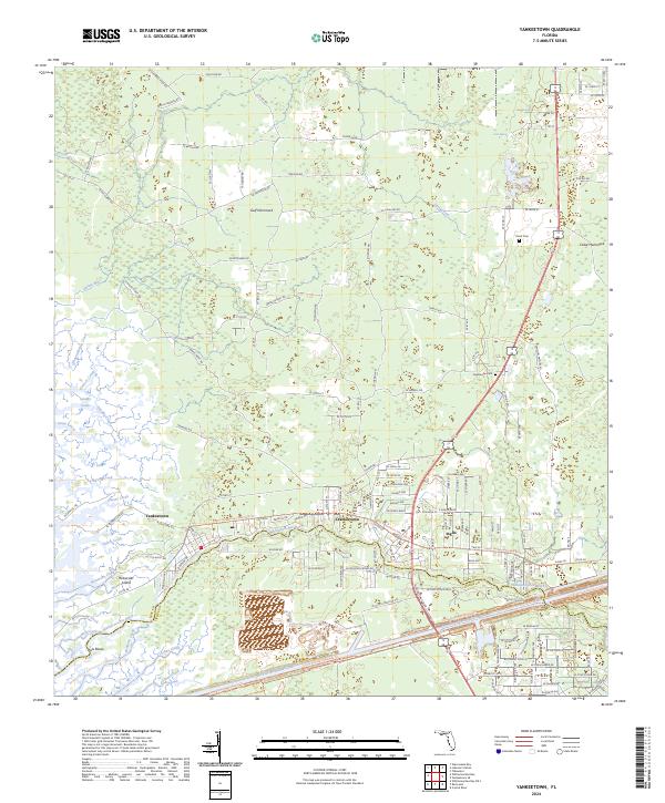
The Withlacoochee River carves a winding path toward the Gulf of Mexico, anchoring the settlements of Yankeetown, Inglis, and Crackertown. This coastal landscape is defined by its transition from tidal wetlands to the dense interior of Gulf Hammock. To the south, the massive engineering of the Cross Florida Barge Canal cuts a straight line through the terrain, contrasting sharply with the natural meanders of the river and creeks like Thousandmile Creek and Bird Creek. Numerous water features such as Big Spring and Sulphur Spring suggest the underlying karst geography of the region.
Find a feature on this map
155 named features on this map. Tap any name to fly to it.
Don’t see what you’re looking for? This feature index may not catch every label — zoom into the map to look around manually.
Map Details
Editions of this 2024 Yankeetown Map
This is the sole edition of this map. No revisions or reprints were ever made.