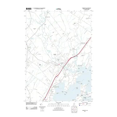
2011 Map of Yarmouth
USGS Topo · Published 2011About this map
The Royal River winds through the heart of Yarmouth, a landscape defined by its transition from wooded uplands to the tidal reach of Casco Bay. This coastal Maine community is characterized by a mix of historic settlement patterns and modern suburban growth, featuring numerous small hamlets such as Crockett Corner, Sodom, and Cumberland Foreside. Industrial history is evident in the water management structures along the river, including the East Elm Street Dam and Bridge Street Dam.
Find a feature on this map
162 named features on this map. Tap any name to fly to it.
Don’t see what you’re looking for? This feature index may not catch every label — zoom into the map to look around manually.
Map Details
Editions of this 2011 Yarmouth Map
This is the sole edition of this map. No revisions or reprints were ever made.
Other maps of this area

1891 · Portland
USGS Topo · 1:62,500

1892 · Freeport
USGS Topo · 1:62,500

1893 · Portland
USGS Topo · 1:62,500

1893 · Casco Bay
USGS Topo · 1:62,500

1894 · Gray
USGS Topo · 1:62,500

1898 · Gray
USGS Topo · 1:62,500

1914 · Portland
USGS Topo · 1:48,000

1914 · Casco Bay
USGS Topo · 1:48,000

1916 · Portland
USGS Topo · 1:62,500

1916 · Casco Bay
USGS Topo · 1:62,500