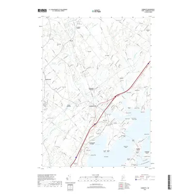
2018 Map of Yarmouth
USGS Topo · Published 2018About this map
Casco Bay defines the southeastern edge of this coastal Maine landscape, where the Royal River meets the sea amid a complex of points and coves. The town of Yarmouth serves as the central hub, situated near the intersection of major transport corridors including the St Lawrence & Atlantic RR. The mapping detail captures the transition from the developed town center to the outlying rural settlements of Crockett Corner, Dunns, and Sodom.
Find a feature on this map
186 named features on this map. Tap any name to fly to it.
Don’t see what you’re looking for? This feature index may not catch every label — zoom into the map to look around manually.
Map Details
Editions of this 2018 Yarmouth Map
This is the sole edition of this map. No revisions or reprints were ever made.
Other maps of this area

1891 · Portland
USGS Topo · 1:62,500

1892 · Freeport
USGS Topo · 1:62,500

1893 · Portland
USGS Topo · 1:62,500

1893 · Casco Bay
USGS Topo · 1:62,500

1894 · Gray
USGS Topo · 1:62,500

1898 · Gray
USGS Topo · 1:62,500

1914 · Portland
USGS Topo · 1:48,000

1914 · Casco Bay
USGS Topo · 1:48,000

1916 · Portland
USGS Topo · 1:62,500

1916 · Casco Bay
USGS Topo · 1:62,500