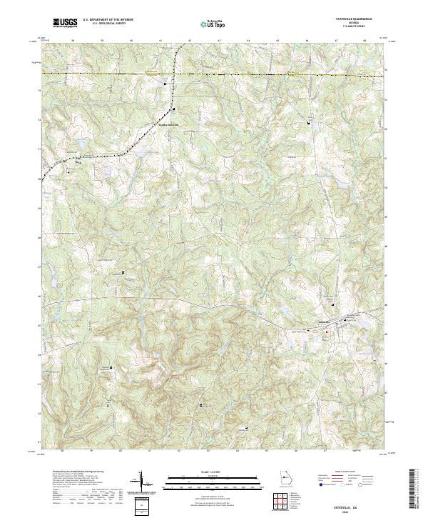
2024 Map of Yatesville
USGS Topo · Published 2024About this map
Yatesville serves as the primary hub in this portion of Upson County, where the landscape is defined by the headwaters of Tobler Creek and Auchumpkee Creek. This area of central Georgia maintains a dense network of family and community landmarks, evidenced by the numerous burial grounds like Salem Cem and Grays Chapel Cem that dot the countryside. The geography is characterized by numerous small lakes and ponds, including McGehee Lake, Nash Lake, and Haygood Lake, which are fed by winding tributaries such as Rose Creek and Weatherford Branch.
Find a feature on this map
94 named features on this map. Tap any name to fly to it.
Don’t see what you’re looking for? This feature index may not catch every label — zoom into the map to look around manually.
Map Details
Editions of this 2024 Yatesville Map
This is the sole edition of this map. No revisions or reprints were ever made.
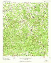
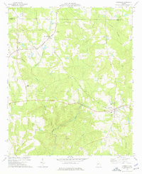
Historical Maps of Yatesville Through Time
3 maps found