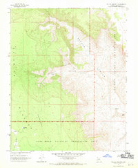
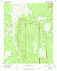
1967 Map of Yellow John Mtn.
USGS Topo · Published 1970About this map
Yellow John Mountain rises above a landscape defined by deep drainages and high tablelands within the Lake Mead National Recreation Area. This mid-century survey captures the remote character of the Shivwits Plateau, where water security was the primary concern for any human activity. The map identifies several vital water sources, including Mud Spring, Dripping Spring, and Lost Spring, alongside man-made improvements like Horseshoe Tank and Pleasant Valley Tank in Pleasant Valley. A single Prospect located near Andrus Canyon suggests early mineral exploration in this isolated portion of Mohave County, though the terrain remains largely undeveloped and preserved for its natural character.
Find a feature on this map
13 named features on this map. Tap any name to fly to it.
Don’t see what you’re looking for? This feature index may not catch every label — zoom into the map to look around manually.
Map Details
Editions of this 1967 Yellow John Mtn. Map
This is the sole edition of this map. No revisions or reprints were ever made.
Other maps of this area

1886 · Mt. Trumbull
USGS Topo · 1:250,000

1892 · Mt. Trumbull
USGS Topo · 1:250,000

1953 · Grand Canyon
USGS Topo · 1:250,000

1957 · Grand Canyon
USGS Topo · 1:250,000

1958 · Grand Canyon
USGS Topo · 1:250,000

1960 · Grand Canyon
USGS Topo · 1:250,000
1967 · Whitmore Point SE
USGS Topo · 1:24,000
1967 · Whitmore Point
USGS Topo · 1:24,000
1967 · Whitmore Point SW
USGS Topo · 1:24,000
1971 · Castle Peak
USGS Topo · 1:24,000