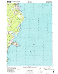
1998 Map of York Beach
USGS Topo · Published 1999About this map
York Beach and Ogunquit anchor this coastal Maine survey, revealing the established resort geography of the late 20th century. The shoreline is punctuated by well-known maritime landmarks, from the narrow inlet of Perkins Cove to the iconic Cape Neddick Lighthouse at The Nubble. Inland, the map reveals the transition from coastal settlements like Concordville and York Cliffs to the wooded interior around Wander Hill and Simpson Hill.
Find a feature on this map
76 named features on this map. Tap any name to fly to it.
Don’t see what you’re looking for? This feature index may not catch every label — zoom into the map to look around manually.
Map Details
Editions of this 1998 York Beach Map
This is the sole edition of this map. No revisions or reprints were ever made.
Other maps of this area

1891 · Biddeford
USGS Topo · 1:62,500

1891 · Kennebunk
USGS Topo · 1:62,500

1893 · Kennebunk
USGS Topo · 1:62,500

1893 · York
USGS Topo · 1:62,500

1893 · Biddeford
USGS Topo · 1:62,500

1898 · Kennebunk
USGS Topo · 1:62,500

1920 · York
USGS Topo · 1:62,500

1941 · Biddeford
USGS Topo · 1:62,500

1941 · Kennebunk
USGS Topo · 1:62,500

1944 · Wells
USGS Topo · 1:24,000