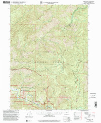
1998 Map of York Butte
USGS Topo · Published 2001About this map
Illinois River flows through the southwestern corner of this landscape, marking the protected corridor of the Illinois National Wild And Scenic River. This territory, largely defined by the Siskiyou National Forest and the Kalmiopsis Wilderness, contains traces of early settlement and resource extraction. The site of Nobles House (Site) and the Pine Creek Camp (Site) point to historical human presence within the drainage basins of Silver Creek and Briggs Creek.
Find a feature on this map
35 named features on this map. Tap any name to fly to it.
Don’t see what you’re looking for? This feature index may not catch every label — zoom into the map to look around manually.
Map Details
Editions of this 1998 York Butte Map
This is the sole edition of this map. No revisions or reprints were ever made.
Other maps of this area

1917 · Kerby
USGS Topo · 1:125,000

1918 · Kerby
USGS Topo · 1:125,000

1945 · Kerby
USGS Topo · 1:125,000

1946 · Galice
USGS Topo · 1:62,500

1948 · Galice
USGS Topo · 1:62,500

1954 · Marial
USGS Topo · 1:62,500

1954 · Selma
USGS Topo · 1:62,500

1954 · Pearsoll Peak
USGS Topo · 1:62,500

1955 · Medford
USGS Topo · 1:250,000

1957 · Medford
USGS Topo · 1:250,000